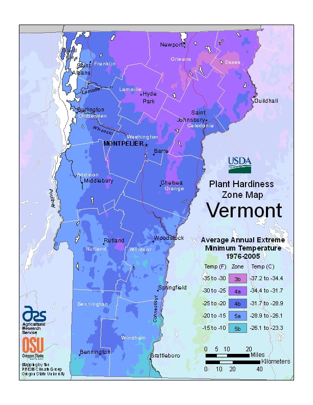
Vermont has a humid continental climate, with muddy springs, in general a mild early summer, hot Augusts, ranging from USDA Plant Hardiness Zones 3b through 5b. Temperatures can vary per different areas of the state so get to know which zone your city is located in so that you can address and avoid potential issues before they become problematic.
The USDA zones map is a useful system for determining what plants will survive and grow in certain areas ofVermont.
Understanding how these hardiness zones work means you can choose the right planting time, and optimize growing for your climate.
Vermont’s hills reveal red, orange, and (on sugar maples) gold foliage as cold weather approaches.
Winters are colder at higher elevations.
It has a Köppen climate classification of Dfb, a temperate continental climate.
The rural northeastern section known as the “Northeast Kingdom” often averages 10 °F (5.6 °C) colder than the southern areas of the state during winter.
The annual snowfall averages between 60 and 100 inches (1,500 and 2,500 mm) depending on elevation.
Vermont is the seventh coldest state in the United States.