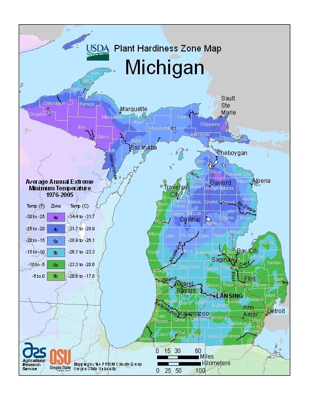
Michigan has a continental climate, although there are two distinct regions, ranging from USDA Plant Hardiness Zones 4a through 6b. Temperatures can vary per different areas of the state so get to know which zone your city is located in so that you can address and avoid potential issues before they become problematic.
The USDA zones map is a useful system for determining what plants will survive and grow in certain areas ofMichigan.
Understanding how these hardiness zones work means you can choose the right planting time, and optimize growing for your climate.
The southern and central parts of the Lower Peninsula (south of Saginaw Bay and from the Grand Rapids area southward) have a warmer climate (Köppen climate classification Dfa) with hot summers and cold winters.
The northern part of Lower Peninsula and the entire Upper Peninsula has a more severe climate (Köppen Dfb), with warm, but shorter summers and longer, cold to very cold winters.
Some parts of the state average high temperatures below freezing from December through February, and into early March in the far northern parts.
During the winter through the middle of February, the state is frequently subjected to heavy lake-effect snow.