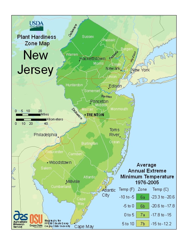
New Jersey’s south, central, and northeast parts of the state have a humid subtropical climate, while the northwest has a humid continental climate (microthermal), with much cooler temperatures due to higher elevation, ranging from USDA Plant Hardiness Zones 6a through 7b. Temperatures can vary per different areas of the state so get to know which zone your city is located in so that you can address and avoid potential issues before they become problematic.
The USDA zones map is a useful system for determining what plants will survive and grow in certain areas ofNew Hampshire.
Understanding how these hardiness zones work means you can choose the right planting time, and optimize growing for your climate.
New Jersey receives between 2,400 and 2,800 hours of sunshine annually.
Climate change is affecting New Jersey faster than much of the rest of the United States. As of 2019, New Jersey was one of the fastest-warming states in the nation. Since 1895, average temperatures have climbed by almost 3.6 degrees Fahrenheit, double the average for the other Lower 48 states.
Summers are typically hot and humid, with statewide average high temperatures of 82–87 °F (28–31 °C) and lows of 60–69 °F (16–21 °C); however, temperatures exceed 90 °F (32 °C) on average 25 days each summer, exceeding 100 °F (38 °C) in some years.
Winters are usually cold, with average high temperatures of 34–43 °F (1–6 °C) and lows of 16 to 28 °F (−9 to −2 °C) for most of the state, but temperatures can, for brief periods, fall below 10 °F (−12 °C) and sometimes rise above 50 °F (10 °C).
Northwestern parts of the state have significantly colder winters with sub-0 °F (−18 °C) being an almost annual occurrence.
Spring and autumn may feature wide temperature variations, with lower humidity than summer. The USDA Plant Hardiness Zone classification ranges from 6 in the northwest of the state, to 7B near Cape May.