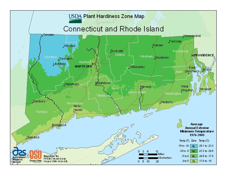
Connecticut is a cooler state, ranging from USDA Plant Hardiness Zones 5b through 7a. Temperatures can vary per different areas of the state so get to know which zone your city is located in so that you can address and avoid potential issues before they become problematic.
The USDA zones map is a useful system for determining what plants will survive and grow in certain areas of Connecticut and Rhode Island.
Understanding how these hardiness zones work means you can choose the right planting time, and optimize growing for your climate.
Connecticut lies at the rough transition zone between the southern end of the humid continental climate, and the northern portion of the humid subtropical climate.
Northern Connecticut generally experiences a climate with cold winters with moderate snowfall and hot, humid summers.
Far southern and coastal Connecticut has a climate with cool winters with a mix of rain and infrequent snow, and the long hot and humid summers typical of the middle and lower East Coast.