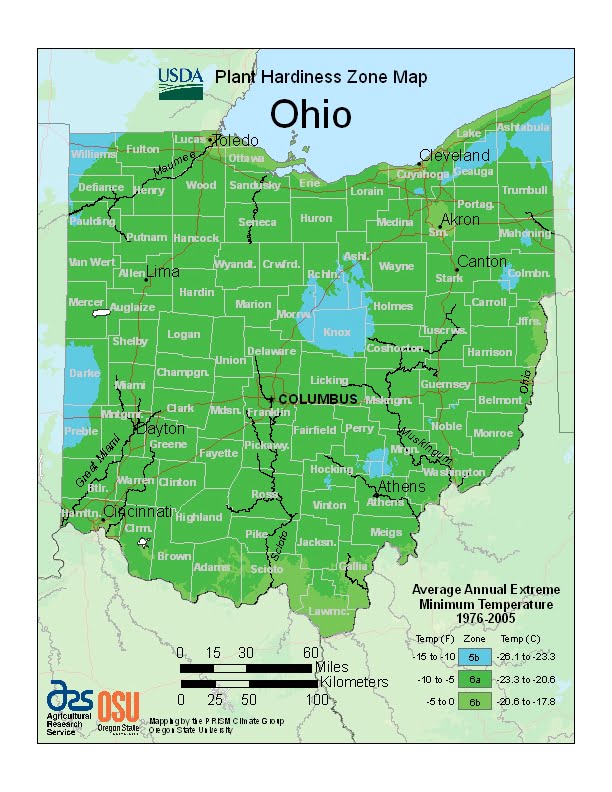
Ohio is a humid continental climate throughout most of the state, ranging from USDA Plant Hardiness Zones 5b through 6b. Temperatures can vary per different areas of the state so get to know which zone your city is located in so that you can address and avoid potential issues before they become problematic.
The USDA zones map is a useful system for determining what plants will survive and grow in certain areas ofOhio.
Understanding how these hardiness zones work means you can choose the right planting time, and optimize growing for your climate.
Ohio’s Bluegrass region section are located on the northern periphery of the humid subtropical climate (Cfa) and Upland South region of the United States.
Summers are typically hot and humid throughout the state, while winters generally range from cool to cold.
Precipitation in Ohio is moderate year-round.
Severe weather is not uncommon in the state, although there are typically fewer tornado reports in Ohio than in states located in what is known as the Tornado Alley.
Severe lake effect snowstorms are also not uncommon on the southeast shore of Lake Erie, which is located in an area designated as the Snowbelt.