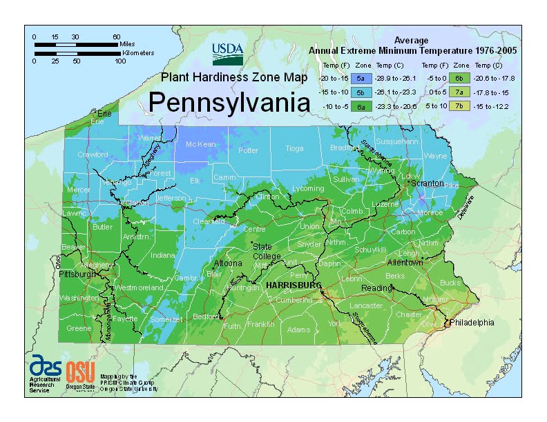
Pennsylvania’s diverse topography also produces a variety of climates, though the entire state experiences cold winters and humid summers, ranging from USDA Plant Hardiness Zones 5a through 7b. Temperatures can vary per different areas of the state so get to know which zone your city is located in so that you can address and avoid potential issues before they become problematic.
The USDA zones map is a useful system for determining what plants will survive and grow in certain areas ofPennsylvania.
Understanding how these hardiness zones work means you can choose the right planting time, and optimize growing for your climate.
Straddling two major zones, the majority of the state, except for the southeastern corner, has a humid continental climate (Köppen climate classification Dfb).
The southern portion of the state has a humid subtropical climate. The largest city, Philadelphia, has a humid subtropical climate (Köppen Cfa).
Summers are generally hot and humid.
Moving toward the mountainous interior of the state, the winter climate becomes colder, the number of cloudy days increases, and snowfall amounts are greater.
Western areas of the state, particularly locations near Lake Erie, can receive over 100 inches (250 cm) of snowfall annually, and the entire state receives plentiful precipitation throughout the year.