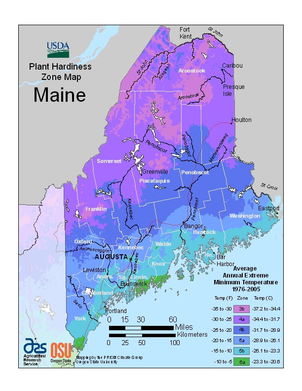
Maine has a humid continental climate, with warm and sometimes humid summers, and long, cold and very snowy winters, ranging from USDA Plant Hardiness Zones 3b through 6a. Temperatures can vary per different areas of the state so get to know which zone your city is located in so that you can address and avoid potential issues before they become problematic.
The USDA zones map is a useful system for determining what plants will survive and grow in certain areas of Maine.
Understanding how these hardiness zones work means you can choose the right planting time, and optimize growing for your climate.
Winters are especially severe in the Northern and Western parts of Maine, while coastal areas are moderated slightly by the Atlantic Ocean, resulting in marginally milder winters and cooler summers than inland regions.
Daytime highs are generally in the 75–80 °F (24–27 °C) range throughout the state in July, with overnight lows in the high 50s °F (around 15 °C).
January temperatures range from highs near 30 °F (−1 °C) on the southern coast to overnight lows averaging below 0 °F (−18 °C) in the far north.
Precipitation in Maine is evenly distributed year-round, but with a slight summer maximum in northern/northwestern Maine and a slight late-fall or early-winter maximum along the coast due to “nor’easters” or intense cold-season rain and snowstorms.