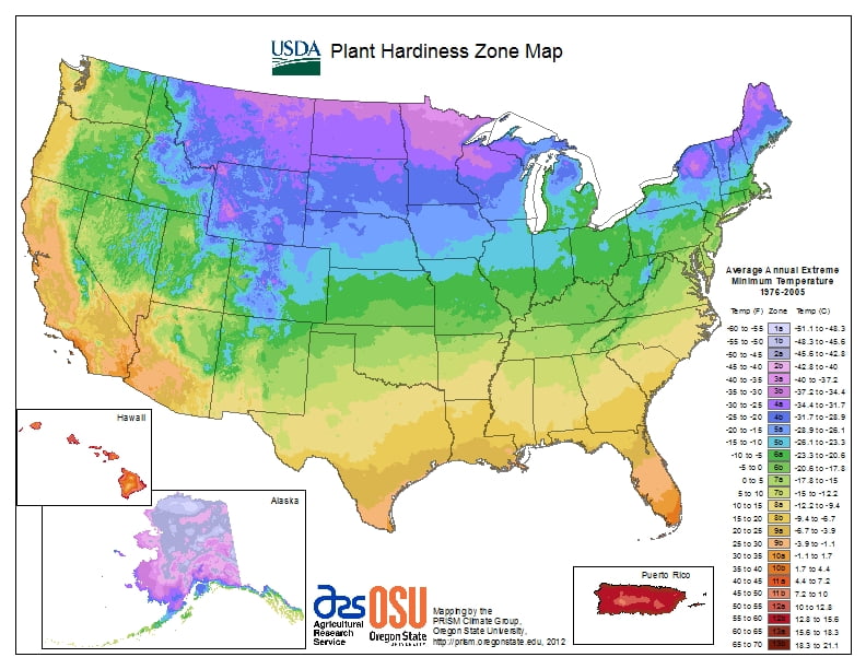
The USDA Plant Hardiness Zone Map was developed using minimum temperature data and is a useful system for determining what plants will survive and grow in certain areas of the U.S.
Each zone represents the mean extreme minimum temperature for an area, calculated from the lowest daily minimum temperature recorded for each of the years of record. These zones show the average of lowest winter temperatures for a given location for this time period.
Individual gardens also may have very localized microclimates so use the data as a guide rater than a written rule and validate it with your own temperature measurements from your garden. Your entire yard could be somewhat warmer or cooler than the surrounding area because it is sheltered or exposed. You also could have pockets within your garden that are warmer or cooler than the general zone for your area or for the rest of your yard, such as a sheltered area in front of a south-facing wall or a low spot where cold air pools first.
Regional
Northwestern
North Central
Northeastern
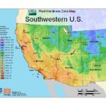
Southwestern
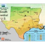
South Central
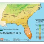
Southeastern