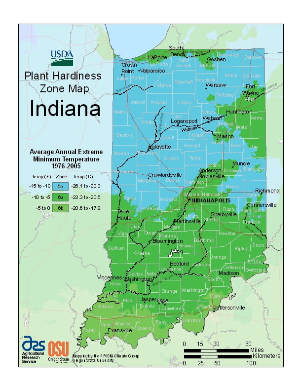
Indiana is historically known as a humid state, with cold winters and hot, wet summers; ranging from USDA Plant Hardiness Zones 5b through 6b. Temperatures can vary per different areas of the state so get to know which zone your city is located in so that you can address and avoid potential issues before they become problematic.
The USDA zones map is a useful system for determining what plants will survive and grow in certain areas of Indiana.
Understanding how these hardiness zones work means you can choose the right planting time, and optimize growing for your climate.
In the past, almost all of Indiana had a humid continental climate (Dfb), with cold winters and hot, wet summers; only the extreme southern portion of the state lay within the humid subtropical climate (Cfb), which receives more precipitation than other parts of Indiana.
But as of the 2016 update, about half the state is now classified as humid subtropical.
Temperatures generally diverge from the north and south sections of the state.
In midwinter, average high/low temperatures range from around 30 °F/15 °F (−1 °C/−10 °C) in the far north to 41 °F/24 °F (5 °C/−4 °C) in the far south.