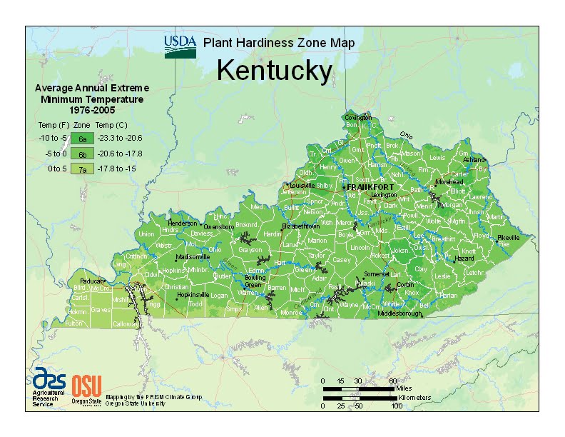
Kentucky has relatively hot, humid, rainy summers, and moderately cold and rainy winters, ranging from USDA Plant Hardiness Zones 6a through 7a. Temperatures can vary per different areas of the state so get to know which zone your city is located in so that you can address and avoid potential issues before they become problematic.
The USDA zones map is a useful system for determining what plants will survive and grow in certain areas of Kentucky.
Understanding how these hardiness zones work means you can choose the right planting time, and optimize growing for your climate.
Located within the southeastern interior portion of North America, Kentucky has a climate that is best described as a humid subtropical climate (Köppen: Cfa), only small higher areas of the southeast of the state has an oceanic climate (Cfb) influenced by the Appalachians.
Temperatures in Kentucky usually range from daytime summer highs of 87 °F (31 °C) to the winter low of 23 °F (−5 °C).
The highest recorded temperature was 114 °F (46 °C) at Greensburg on July 28, 1930, while the lowest recorded temperature was −37 °F (−38 °C) at Shelbyville on January 19, 1994.
The state rarely experiences the extreme cold of far northern states, nor the high heat of the states in the Deep South. Temperatures seldom drop below 0 degrees or rise above 100 degrees.