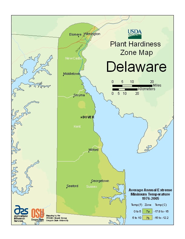
Delaware is a milder state, ranging from USDA Plant Hardiness Zones 7a through 7b. Temperatures can vary per different areas of the state so get to know which zone your city is located in so that you can address and avoid potential issues before they become problematic.
The USDA zones map is a useful system for determining what plants will survive and grow in certain areas of Delaware.
Understanding how these hardiness zones work means you can choose the right planting time, and optimize growing for your climate.
Since almost all of Delaware is a part of the Atlantic coastal plain, the effects of the ocean moderate its climate.
The state lies in the humid subtropical climate (Cfa) zone. Despite its small size (roughly 100 miles (160 km) from its northernmost to southernmost points), there is significant variation in mean temperature and amount of snowfall between Sussex County and New Castle County.
Moderated by the Atlantic Ocean and Delaware Bay, the southern portion of the state has a milder climate and a longer growing season than the northern portion of the state.
Delaware’s all-time record high of 110 °F (43 °C) was recorded at Millsboro on July 21, 1930. The all-time record low of −17 °F (−27 °C) was also recorded at Millsboro, on January 17, 1893. The hardiness zones are 7a and 7b.