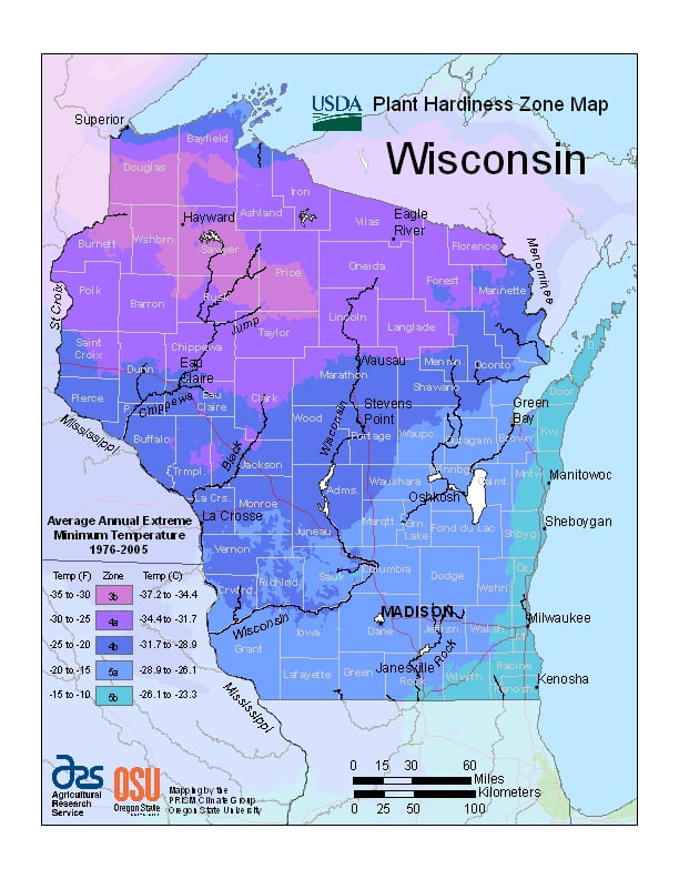
Wisconsin is classified as a warm-summer humid continental climate, ranging from USDA Plant Hardiness Zones 3b through 5b. Temperatures can vary per different areas of the state so get to know which zone your city is located in so that you can address and avoid potential issues before they become problematic.
The USDA zones map is a useful system for determining what plants will survive and grow in certain areas of SouthWisconsin.
Understanding how these hardiness zones work means you can choose the right planting time, and optimize growing for your climate.
Wisconsin’s southern and southwestern portions are classified as hot-summer humid continental climate.
The highest temperature ever recorded in the state was in the Wisconsin Dells, where it reached 114 °F (46 °C). The lowest temperature ever recorded in Wisconsin was in the village of Couderay, where it reached −55 °F (−48 °C) on both February 2 and 4, 1996.
Wisconsin also receives a large amount of regular snowfall averaging around 40 inches (100 cm) in the southern portions with up to 160 inches (410 cm) annually in the Lake Superior snowbelt each year.