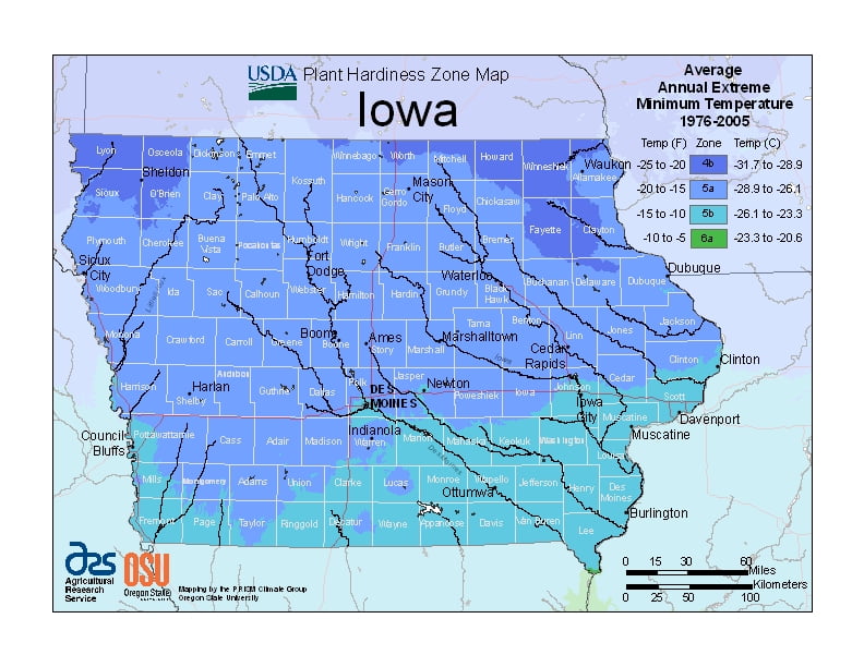
Iowa has a humid continental climate throughout the state with extremes of both heat and cold, ranging from USDA Plant Hardiness Zones 4b through 6a. Temperatures can vary per different areas of the state so get to know which zone your city is located in so that you can address and avoid potential issues before they become problematic.
The USDA zones map is a useful system for determining what plants will survive and grow in certain areas of Iowa.
Understanding how these hardiness zones work means you can choose the right planting time, and optimize growing for your climate.
The average annual temperature at Des Moines is 50 °F (10 °C); for some locations in the north, such as Mason City, the figure is about 45 °F (7 °C), while Keokuk, on the Mississippi River, averages 52 °F (11 °C).
Snowfall is common, with Des Moines getting about 26 days of snowfall a year, and other places, such as Shenandoah getting about 11 days of snowfall in a year.
Spring ushers in the beginning of the severe weather season.
Iowa averages about 50 days of thunderstorm activity per year.
The 30-year annual average of tornadoes in Iowa is 47.
Iowa summers are known for heat and humidity, with daytime temperatures sometimes near 90 °F (32 °C) and occasionally exceeding 100 °F (38 °C).