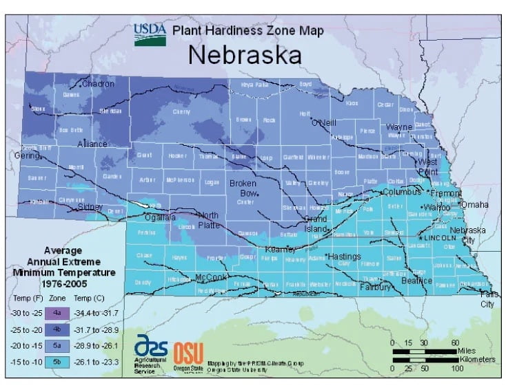
Average temperatures are fairly uniform across Nebraska, ranging from USDA Plant Hardiness Zones 4a through 5b. Temperatures can vary per different areas of the state so get to know which zone your city is located in so that you can address and avoid potential issues before they become problematic.
The USDA zones map is a useful system for determining what plants will survive and grow in certain areas ofNebraska.
Understanding how these hardiness zones work means you can choose the right planting time, and optimize growing for your climate.
The eastern two-thirds of the state has a humid continental climate, although the southwest of this region may be classed as a humid subtropical climate (Cfa) using the −3 °C or 26.6 °F boundary.
The Panhandle and adjacent areas bordering Colorado have a semi-arid climate.
The entire state experiences wide seasonal variations in both temperature and precipitation.
Average temperatures are fairly uniform across Nebraska, with hot summers and generally cold winters. However, chinook winds from the Rocky Mountains provide a temporary moderating effect on temperatures in the state’s western portion during the winter.