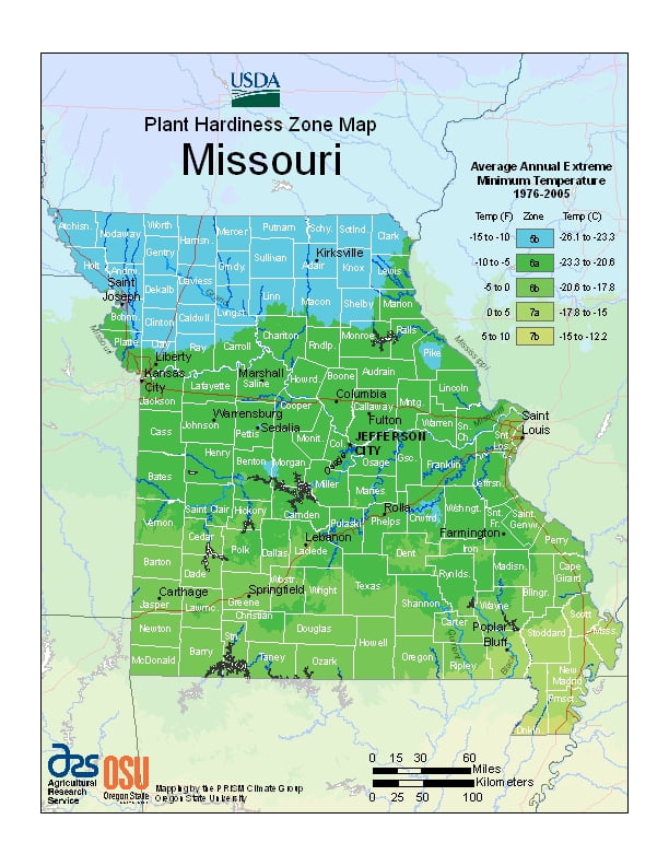
Missouri generally has a humid continental climate with cool, sometimes cold, winters and hot, humid, and wet summers, ranging from USDA Plant Hardiness Zones 4b through 6a. Temperatures can vary per different areas of the state so get to know which zone your city is located in so that you can address and avoid potential issues before they become problematic.
The USDA zones map is a useful system for determining what plants will survive and grow in certain areas ofMissouri.
Understanding how these hardiness zones work means you can choose the right planting time, and optimize growing for your climate.
In the southern part of the state, particularly in the Bootheel, the climate becomes humid subtropical.
Located in the interior United States, Missouri often experiences extreme temperatures.
Without high mountains or oceans nearby to moderate temperature, its climate is alternately influenced by air from the cold Arctic and the hot and humid Gulf of Mexico.
Missouri’s highest recorded temperature is 118 °F (48 °C) at Warsaw and Union on July 14, 1954, while the lowest recorded temperature is −40 °F (−40 °C) also at Warsaw on February 13, 1905.