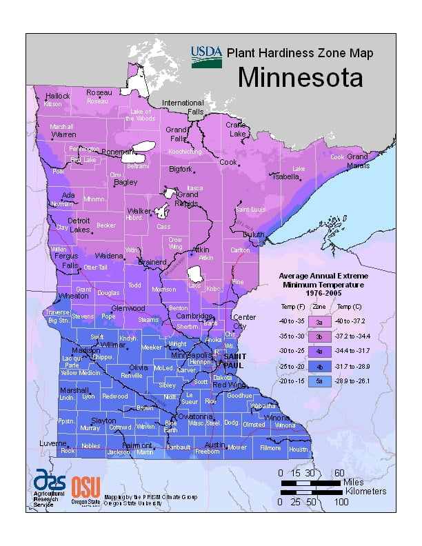
Minnesota experiences temperature extremes characteristic of its continental climate, ranging from USDA Plant Hardiness Zones 4b through 6a. Temperatures can vary per different areas of the state so get to know which zone your city is located in so that you can address and avoid potential issues before they become problematic.
The USDA zones map is a useful system for determining what plants will survive and grow in certain areas of Minnesota.
Understanding how these hardiness zones work means you can choose the right planting time, and optimize growing for your climate.
Meteorological events include rain, snow, blizzards, thunderstorms, hail, derechos, tornadoes, and high-velocity straight-line winds.
The growing season varies from 90 days in the far northeast to 160 days in southeast Minnesota near the Mississippi River, and average temperatures range from 37 to 49 °F (3 to 9 °C).
Average summer dewpoints range from about 58 °F (14 °C) in the south to about 48 °F (9 °C) in the north.
Average annual precipitation ranges from 19 to 35 inches (48 to 89 cm), and droughts occur every 10 to 50 years.