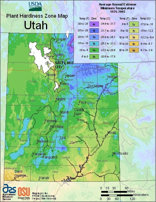
Utah features a dry, semi-arid to desert climate, although its many mountains feature a large variety of climates, ranging from USDA Plant Hardiness Zones 4a through 9a.The state has variable weather per different areas so get to know which zone your city is located in so that you can address and avoid potential issues before they become problematic.
The USDA zones map is a useful system for determining what plants will survive and grow in certain areas ofUtah.
Understanding how these hardiness zones work means you can choose the right planting time, and optimize growing for your climate.
The dry weather is a result of the state’s location in the rain shadow of the Sierra Nevada in California.
The eastern half of the state lies in the rain shadow of the Wasatch Mountains.
The primary source of precipitation for the state is the Pacific Ocean, with the state usually lying in the path of large Pacific storms from October to May.
In summer, the state, especially southern and eastern Utah, lies in the path of monsoon moisture from the Gulf of California.