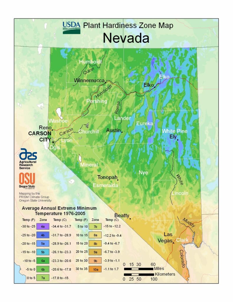
Nevada is the driest state in the United States, ranging from USDA Plant Hardiness Zones 4a through 10a.The state has variable weather per different areas so get to know which zone your city is located in so that you can address and avoid potential issues before they become problematic.
The USDA zones map is a useful system for determining what plants will survive and grow in certain areas ofNevada.
Understanding how these hardiness zones work means you can choose the right planting time, and optimize growing for your climate.
Nevada is made up of mostly desert and semi-arid climate regions, and, with the exception of the Las Vegas Valley, the average summer diurnal temperature range approaches 40 °F (22 °C) in much of the state.
While winters in northern Nevada are long and fairly cold, the winter season in the southern part of the state tends to be of short duration and mild.
Most parts of Nevada receive scarce precipitation during the year. The most rain that falls in the state falls on the east and northeast slopes of the Sierra Nevada.