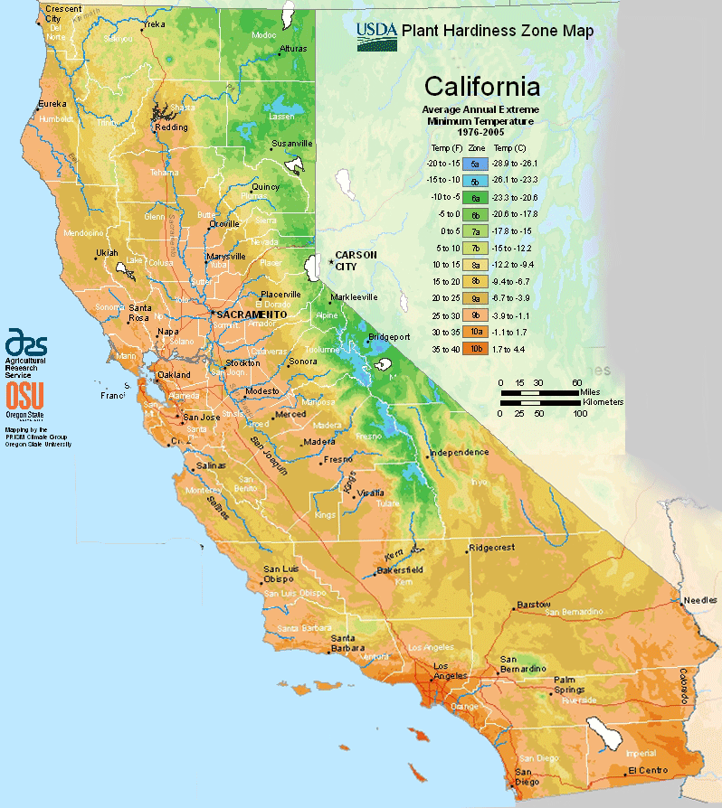
California has a Mediterranean climate, due to the state’s large size the climate ranges from polar to subtropical, ranging from USDA Plant Hardiness Zones 5a through 10b.The state has variable weather per different areas so get to know which zone your city is located in so that you can address and avoid potential issues before they become problematic.
The USDA zones map is a useful system for determining what plants will survive and grow in certain areas ofCalifornia.
Understanding how these hardiness zones work means you can choose the right planting time, and optimize growing for your climate.
The cool California Current offshore often creates summer fog near the coast. Further inland, there are colder winters and hotter summers.
The maritime moderation results in the shoreline summertime temperatures of Los Angeles and San Francisco being the coolest of all major metropolitan areas of the United States and uniquely cool compared to areas on the same latitude in the interior and on the east coast of the North American continent.
San Diego shoreline bordering Mexico is cooler in summer than most areas in the contiguous United States.
Just a few miles inland, summer temperature extremes are significantly higher, with downtown Los Angeles being several degrees warmer than at the coast.
The same microclimate phenomenon is seen in the climate of the Bay Area, where areas sheltered from the sea experience significantly hotter summers than nearby areas closer to the ocean.
Northern parts of the state have more rain than the south.
California’s mountain ranges also influence the climate: some of the rainiest parts of the state are west-facing mountain slopes.
Northwestern California has a temperate climate, and the Central Valley has a Mediterranean climate but with greater temperature extremes than the coast.