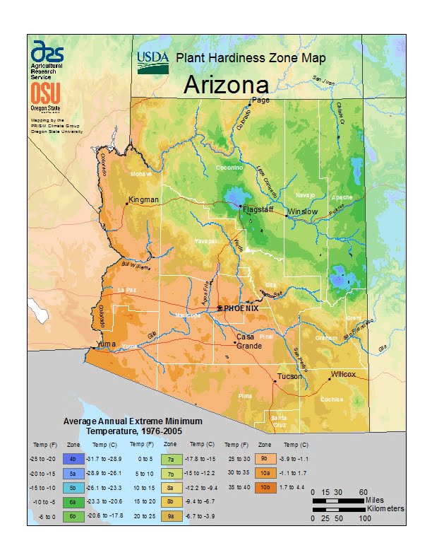
Arizona covers a large area and variations in elevation, the state has a wide variety of localized climate conditions, ranging from USDA Plant Hardiness Zones 4b through 8a.The state has variable weather per different areas so get to know which zone your city is located in so that you can address and avoid potential issues before they become problematic.
The USDA zones map is a useful system for determining what plants will survive and grow in certain areas ofArizona.
Understanding how these hardiness zones work means you can choose the right planting time, and optimize growing for your climate.
In the lower elevations, the climate is primarily desert, with mild winters and extremely hot summers.
Typically, from late fall to early spring, the weather is mild, averaging a minimum of 60 °F (16 °C).
November through February are the coldest months, with temperatures typically ranging from 40 to 75 °F (4 to 24 °C), with occasional frosts.
About midway through February, the temperatures start to rise, with warm days, and cool, breezy nights.
The summer months of June through September bring a dry heat from 90 to 120 °F (32 to 49 °C), with occasional high temperatures exceeding 125 °F (52 °C) having been observed in the desert area.
Arizona has an average annual rainfall of 12.7 in (323 mm), which comes during two rainy seasons, with cold fronts coming from the Pacific Ocean during the winter and a monsoon in the summer.