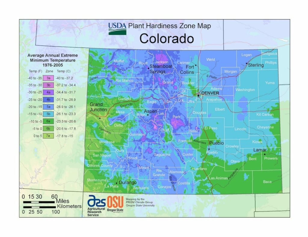
The climate of Colorado is more complex than states outside of the Mountain States region, ranging from USDA Plant Hardiness Zones 3a through 7a.The state has variable weather per different areas so get to know which zone your city is located in so that you can address and avoid potential issues before they become problematic.
The USDA zones map is a useful system for determining what plants will survive and grow in certain areas ofColorado.
Understanding how these hardiness zones work means you can choose the right planting time, and optimize growing for your climate.
Unlike most other states, southern Colorado is not always warmer than northern Colorado.
Most of Colorado is made up of mountains, foothills, high plains, and desert lands.
Mountains and surrounding valleys greatly affect local climate.
Northeast, east, and southeast Colorado are mostly the high plains, while Northern Colorado is a mix of high plains, foothills, and mountains.
Northwest and west Colorado are predominantly mountainous, with some desert lands mixed in.
Southwest and southern Colorado are a complex mixture of desert and mountain areas.