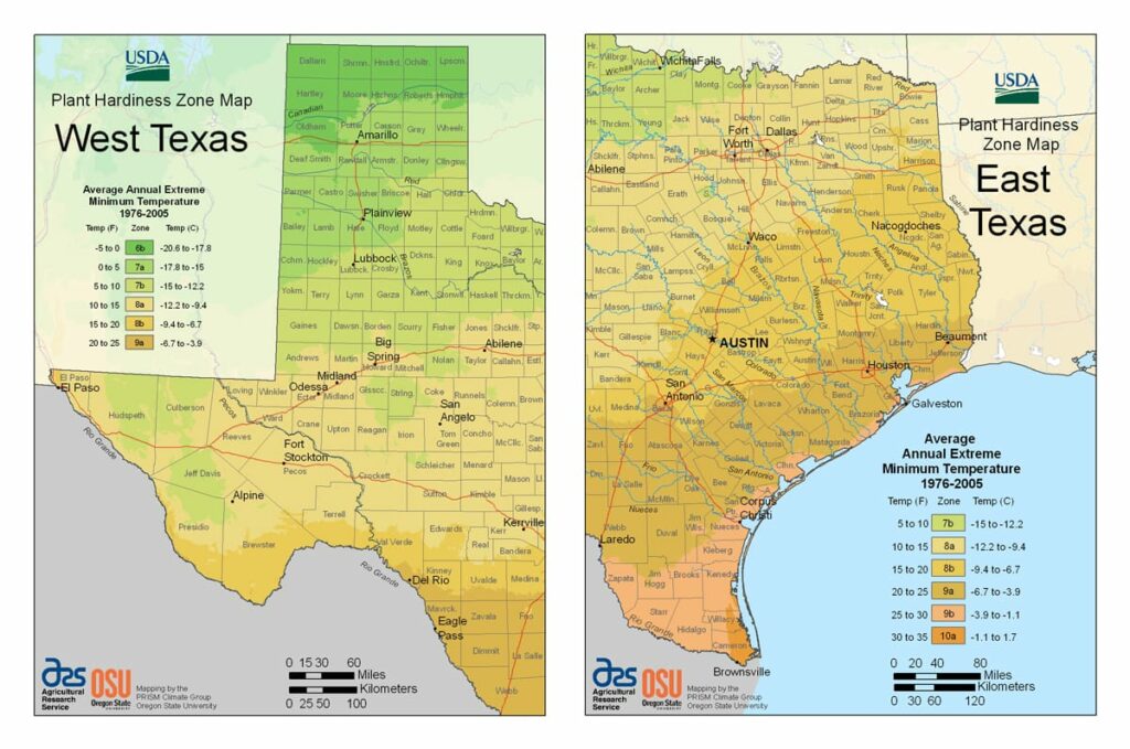
Texas experiences multiple climate zones, ranging from USDA Plant Hardiness Zones 6b through 10a.The state has highly variable weather per different areas so get to know which zone your city is located in so that you can address and avoid potential issues before they become problematic.
The USDA zones map is a useful system for determining what plants will survive and grow in certain areas ofTexas.
Understanding how these hardiness zones work means you can choose the right planting time, and optimize growing for your climate.
The Panhandle of the state has colder winters than North Texas, while the Gulf Coast has mild winters.
Texas has wide variations in precipitation patterns. El Paso, on the western end of the state, averages 8.7 inches (220 mm) of annual rainfall, while parts of southeast Texas average as much as 64 inches (1,600 mm) per year. Dallas in the North Central region averages a more moderate 37 inches (940 mm) per year.
Snow falls multiple times each winter in the Panhandle and mountainous areas of West Texas, once or twice a year in North Texas, and once every few years in Central and East Texas.
Maximum temperatures in the summer months average from the 80s °F (26 °C) in the mountains of West Texas and on Galveston Island to around 100 °F (38 °C) in the Rio Grande Valley, but most areas of Texas see consistent summer high temperatures in the 90 °F (32 °C) range.