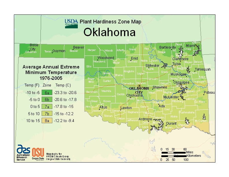
Oklahoma is in a humid subtropical region ranging from USDA Plant Hardiness Zones 6a through 8a.Oklahoma’s climate varies widely per different areas of the state so get to know which zone your city is located in so that you can address and avoid potential issues before they become problematic.
The USDA zones map is a useful system for determining what plants will survive and grow in certain areas ofOklahoma.
Understanding how these hardiness zones work means you can choose the right planting time, and optimize growing for your climate.
Oklahoma lies in a transition zone between semi-arid further to the west, humid continental to the north, and humid subtropical to the east and southeast.
Most of the state lies in an area known as Tornado Alley characterized by frequent interaction between cold, dry air from Canada, warm to hot, dry air from Mexico and the Southwestern U.S., and warm, moist air from the Gulf of Mexico.
An average 62 tornadoes strike the state per year—one of the highest rates in the world.
Precipitation and temperatures decline from east to west accordingly, with areas in the southeast averaging an annual temperature of 62 °F (17 °C) and an annual rainfall of generally over 40 inches.
Over almost all of Oklahoma, winter is the driest season.