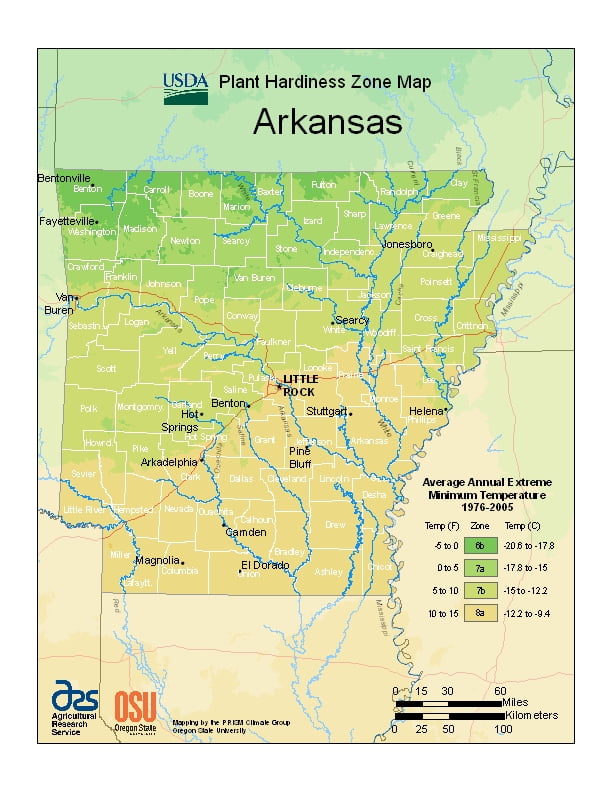
Arkansas generally has a humid subtropical climate, ranging from USDA Plant Hardiness Zones 6b through 8a. Arkansas climate varies widely per different areas of the state so get to know which zone your city is located in so that you can address and avoid potential issues before they become problematic.
The USDA zones map is a useful system for determining what plants will survive and grow in certain areas ofArkansas.
Understanding how these hardiness zones work means you can choose the right planting time, and optimize growing for your climate.
Arkansas is close enough to the Gulf of Mexico for it to influence the weather in the state.
Generally, Arkansas, has hot, humid summers and slightly drier, mild to cool winters.
In Little Rock, the daily high temperatures average around 93 °F (34 °C) with lows around 73 °F (23 °C) in July. In January highs average around 51 °F (11 °C) and lows around 32 °F (0 °C).
It is somewhat wetter in the south and drier in the northern part of the state.
Snowfall is infrequent but most common in the northern half of the state.
The half of the state south of Little Rock is apter to see ice storms.