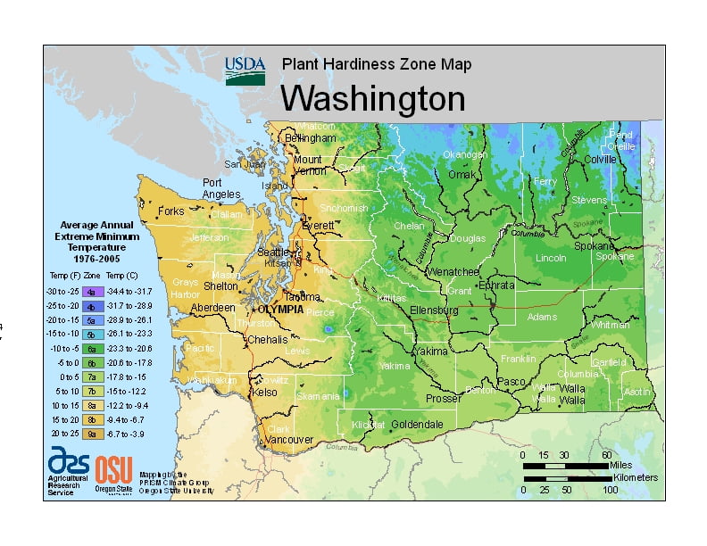
Washington’s climate includes the large semi-permanent high pressure and low pressure systems of the north Pacific Ocean, the continental air masses of North America, and the Olympic and Cascade mountains, ranging from USDA Plant Hardiness Zones 4a through 9a.Washington’s climate varies widely per different areas of the state so get to know which zone your city is located in so that you can address and avoid potential issues before they become problematic.
The USDA zones map is a useful system for determining what plants will survive and grow in certain areas ofWashington.
Understanding how these hardiness zones work means you can choose the right planting time, and optimize growing for your climate.
In the spring and summer, a high pressure anticyclone system dominates the north Pacific Ocean, causing air to spiral out in a clockwise fashion. For Washington, this means prevailing winds from the northwest bring relatively cool air and a predictably dry season.
In the autumn and winter, a low-pressure cyclone system takes over in the north Pacific Ocean.
The air spiraling inward in a counter-clockwise fashion causes Washington’s prevailing winds to come from the southwest, and bring relatively warm and moist air masses and a predictably wet season.