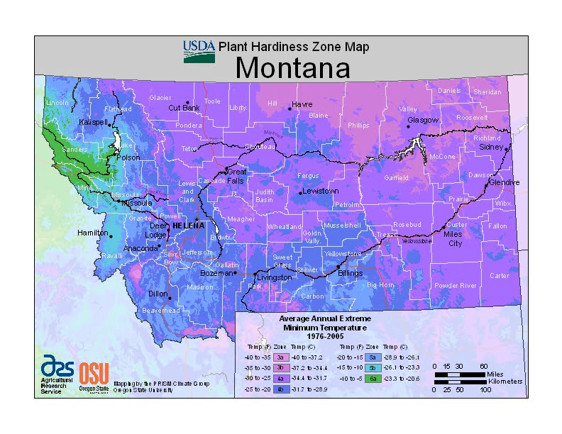
Montana is a large state with considerable variation in geography, topography and elevation, and the climate is equally varied, ranging from USDA Plant Hardiness Zones 3a through 6a. Montana’s climate varies widely per different areas of the state so get to know which zone your city is located in so that you can address and avoid potential issues before they become problematic.
The USDA zones map is a useful system for determining what plants will survive and grow in certain areas ofMontana.
Understanding how these hardiness zones work means you can choose the right planting time, and optimize growing for your climate.
The state spans from below the 45th parallel (the line equidistant between the equator and North Pole) to the 49th parallel, and elevations range from under 2,000 feet (610 m) to nearly 13,000 feet (4,000 m) above sea level.
The western half is mountainous, interrupted by numerous large valleys.
Eastern Montana comprises plains and badlands, broken by hills and isolated mountain ranges, and has a semiarid, continental climate (Köppen climate classification BSk).
The Continental Divide has a considerable effect on the climate, as it restricts the flow of warmer air from the Pacific from moving east, and drier continental air from moving west.
The area west of the divide has a modified northern Pacific Coast climate, with milder winters, cooler summers, less wind, and a longer growing season.