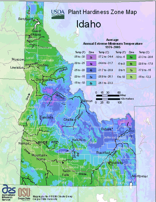
Idaho is a state in the Pacific Northwest region of the United States, ranging from USDA Plant Hardiness Zones 3b through 7b. Idaho’s climate varies widely per different areas of the state so get to know which zone your city is located in so that you can address and avoid potential issues before they become problematic.
The USDA zones map is a useful system for determining what plants will survive and grow in certain areas ofIdaho.
Understanding how these hardiness zones work means you can choose the right planting time, and optimize growing for your climate.
Idaho borders the state of Montana to the east and northeast, Wyoming to the east, Nevada and Utah to the south, and Washington and Oregon to the west.
To the north, it shares a small portion of the Canadian border with the province of British Columbia.
Idaho’s climate varies widely. Although the state’s western border is about 330 miles (530 km) from the Pacific Ocean, the maritime influence is still felt in Idaho, especially in the winter when cloud cover, humidity, and precipitation are at their maximum extent.
This influence has a moderating effect in the winter where temperatures are not as low as would otherwise be expected for a northern state with predominantly high elevations.
In the panhandle, moist air masses from the coast are released as precipitation over the North Central Rockies forests, creating the North American inland temperate rainforest.