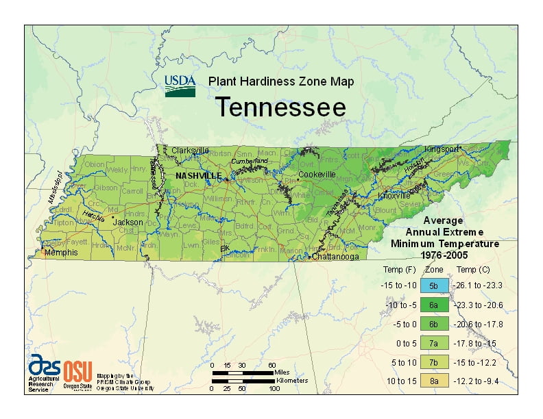
Tennessee has a humid subtropical climate, ranging from USDA Plant Hardiness Zones 5b through 8a.The state has variable weather per different areas so get to know which zone your city is located in so that you can address and avoid potential issues before they become problematic.
The USDA zones map is a useful system for determining what plants will survive and grow in certain areas ofTennessee.
Understanding how these hardiness zones work means you can choose the right planting time, and optimize growing for your climate.
The Gulf of Mexico is the dominant factor in Tennessee’s climate, with winds from the south responsible for most of the state’s annual precipitation.
Tennessee receives an average of 50 inches (130 cm) of precipitation annually.
Generally, the state has hot summers and mild to cool winters with generous precipitation throughout the year.
The highest average monthly precipitation usually occurs between December and April.
The driest months, on average, are August to October.
Snowfall ranges from 5 inches (13 cm) in West Tennessee to over 80 inches (200 cm) in East Tennessee’s highest mountains.