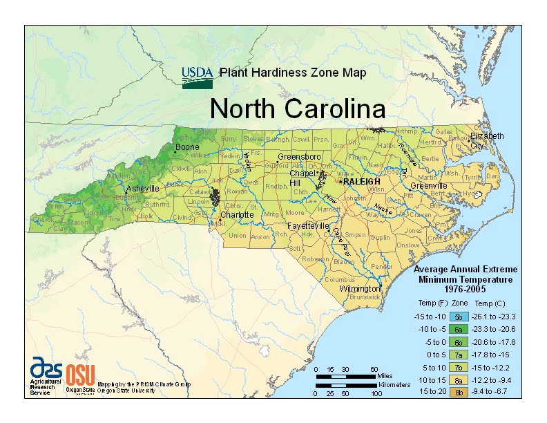
North Carolina’s climate varies from the Atlantic coast in the east to the Appalachian Mountain range in the west, ranging from USDA Plant Hardiness Zones 5b through 8b.The state has variable weather per different areas so get to know which zone your city is located in so that you can address and avoid potential issues before they become problematic.
The USDA zones map is a useful system for determining what plants will survive and grow in certain areas ofNorth Carolina.
Understanding how these hardiness zones work means you can choose the right planting time, and optimize growing for your climate.
Most of the state has a humid subtropical climate, except in the higher elevations of the Appalachians which have a subtropical highland climate.
There is an average of 45 inches of rain a year (50 inches in mountainous regions).
July storms account for much of this precipitation. As much as 15% of the rainfall during the warm season in the Carolinas can be attributed to tropical cyclones.