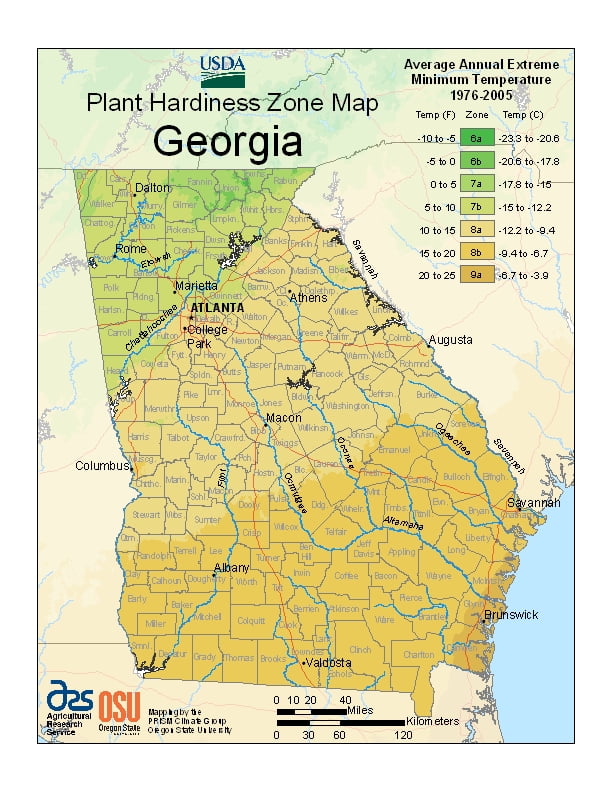
The majority of Georgia is primarily a humid subtropical climate, ranging from USDA Plant Hardiness Zones 6a through 9a.The state has variable weather per different areas so get to know which zone your city is located in so that you can address and avoid potential issues before they become problematic.
The USDA zones map is a useful system for determining what plants will survive and grow in certain areas ofGeorgia.
Understanding how these hardiness zones work means you can choose the right planting time, and optimize growing for your climate.
The entire state, including the North Georgia mountains, receives moderate to heavy precipitation, which varies from 45 inches (1143 mm) in central Georgia to approximately 75 inches (1905 mm) around the northeast part of the state.
Georgia is one of the leading states in frequency of tornadoes, though they are rarely stronger than EF1.
With a coastline on the Atlantic Ocean, Georgia is also vulnerable to hurricanes, although direct hurricane strikes were rare.